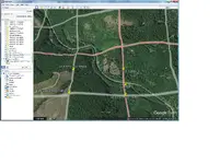
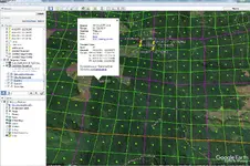
Unfortunately the PLSS download for Google Earth is the old abandoned (in 2008) inaccurate PLSS. The 2008 version on Google Earth is as much as 1/4 mile off in several areas.
The new CadNSDI PLSS is a lot more accurate and corrects a lot of the errors that were in the old 2008 version. The new CadNSDI is being actively improved every month.
Land Matters uses the new more accurate CadNSDI PLSS and updates it regularly. For quite a while Land Matters has been the only website offering the new CadNSDI in our mapping. I see that a few web maps are partially implementing the new PLSS now but I don't see anyone else displaying the full version.
The only area that has a kml that can be used in Google Earth to display the new CadNSDI are a few small areas in New Mexico. I'm sure that will change in time but for now if you want to view the more accurate new PLSS Land Matters is the place.
You can download the new CadNSDI PLSS from the BLM Navigator. As usual their system is so unwieldy that you would probably never find it with a search so here is the
LINK. The file is about 1 Gigabyte compressed and it's in a .gdb file format that expands to nearly 10 Gigabytes. If you have a high end mapping program you can probably open that file if you have enough processing power and memory. If you get that far you will immediately notice there are some severe errors that make the file mostly unusable.

We spent more than 4 months fixing those errors so the data could be displayed and used on a map. We felt that the actual reference grid for land descriptions had to be as accurate as possible for our users. All legal land descriptions in 34 States rely on this grid. The fact that we dug in and did the work is why we had the only full working copy available to the public.

Back to overlaying on Google Earth. I understand the idea would be to make a copy of a Land Matters map and stretch it to fit over Google Earth. The problem is what are you going to use as a reference points to make the map picture fit over Google Earth? Being that the PLSS isn't going to line up between the two maps that might put you a quarter mile off. That's just the beginnings of the problems you are going to encounter. Here are just a few more:
Google uses an imaginary
map projection. Study all those wacky map projections of the earths shape, at that link, and realize that the Google map projection is less accurate than all of them.
With several thousand well documented models for making accurate maps Google couldn't get any of those to work fast enough. So they made their own. Nothing wrong with that, people have been making their own projections for centuries. But Google didn't follow the rules for map projections so they would end up with an accurate map. Their projection is always inaccurate in all dimensions. The map projection Google came up with is named 900913. Isn't that cute? Google spelled their name in numbers! The projection they created is so bad that nobody can get an accurate conversion to a real map projection.
Land Matters maps are presented in several very accurate projections that don't in any way line up with the Google Earth silly made up map projection. That means no matter how much you push the image around to match Google you will only get less accuracy for your efforts.
You might think I'm just sour on Google Earth but Google agrees with me. Here's their statement on the accuracy of their maps.
Google makes no claims as to the accuracy of the coordinates in Google Earth. These are provided for entertainment only and should not be used for any navigational or other purpose requiring any accuracy whatsoever.
Our imagery varies from sub-meter resolution in major cities to 15 meter (90 foot) resolution for most of the earth's surface, with a global base resolution of 1KM. Since our database is constantly being updated, we cannot state a specific resolution for any geographic region.
Once you turn on the "3D" terrain feature those very inaccurate Google Earth maps become much less accurate. Essentially you are working strictly in fantasy land as far as locational accuracy is concerned with 3D turned on.
I work very hard to try to provide accurate reliable mapping. On most map layers presented by Land Matters the accuracy goal is 30 foot, about the same as GPS. Not all map layers on Land Matters are that accurate but a good deal of time is devoted to updating and modifying map data that doesn't meet that standard. Ultimately the goal of 30 foot accuracy will not be possible but at least we are attempting to make the most accurate maps possible - not something around
maybe 3,300 foot accuracy like Google Earth.
Google Earth is sometimes a good way to visualize an area you have an interest in. The lack of accuracy of the mapping system itself probably doesn't matter to people looking for entertainment or a general view of an area. It is a valid tool in your research tool box. It's kind of like having a tape measure made out of elastic. It can give you a general idea of how big something is but it really doesn't have any accuracy at all if you need to know how big or long something is or how far and in what direction it is from another object.
Mining Claims and land boundaries don't do well with an elastic tape measure. When your goal is to locate a mining claim on the ground getting less accurate is a really bad idea. Mining somebody's claim or their private land because it looked good to go with a picture of a Land Matters map on Google Earth can result in unpleasant encounters and jail time. Trying to explain that Google said it was OK isn't really going to fly with the irate claim owner. Bad locational information from a land survey abandoned 10 years ago due to lack of accuracy isn't really something to rely on when you are locating mining claims. You need the best information possible, not just good enough for entertainment.
There is another reason I think overlaying copies of Land Matters maps on Google Earth is bad juju. Land Matters is the only non-profit providing free mapping of land status areas like mining claims. Obviously and publicly their intent is to provide accurate mapping of the public and private lands that really has never been made available in one place. A lot of what Land Matters presents on their maps for free is information you can not get anywhere else. When you take the copyright product of those custom maps and put them into the public for profit mapping of Google Earth you not only end up with an inferior map but you also are supporting a large company with the efforts of a small not for profit created for your benefit. Eventually you will kill the goose that lays the golden eggs in favor of an entertainment session.
Goldwasher made several very valid points.
"Be aware that NO online map source is 100% accurate."
No matter how good the maps get there will always be a disconnect between what is displayed on the map and the actual situation on the ground. We can only try to be
accurate when making a map. That accuracy can't possibly translate into the reality of what you will find when you put boots on the ground. That's why I feel you are a lot better off with the best accuracy and the most up to date information possible. A lot of good mapping is about reducing the disconnect between what's displayed on the map and what the reality is.
"Once you start researching the location as it is claimed at the county you will start to see where things get muddied up when they go from paper to digital."
Neither Land Matters nor any other mapping system can provide up to date mapping and information on mining claims. Land Matters does update their mining claims maps more frequently than any other system and they are the only maps with direct links to the most current LR2000 claims data. That will never be enough information on a mining claims map to know what you will find at the County Recorder's office or when you put boots on the ground. Land Matters is the best and most current but they do not provide the final answer, just the tools to get you there.
Heavy Pans


