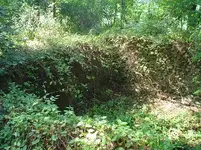
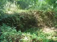
old foundation

Dr.Jones

Full Member
Aug 19, 2005
130
90
Kennett square , PA
Detector(s) used
Minelab E-Trac
I have a question, how would I go about finding out what stood here years ago. There is an old foundation near my house, well about 10 min down the road, and its made out of stone, no concrete, just medium size rocks that make a foundation of what i am assuming was a house. You cant see it from the road, its overgrown and pretty hard to get to, is there any avenues that I can take to find out what was here.

Thanks for your time and input
 

Upvote 0
1. Find the oldest person in the neighborhood (who's been local the longest) and ask them.
2. Look for land records at the county courthouse and check with kin who may know.
3. If you have a historical society or historical section in your library, check there.

Depending on where you are located, it may not be as old as you think. Some locales grow up and turn to forests overnight (like Louisiana). If there's no cement/concrete in it, it is probably very old. A lot of times, though, stones were stacked in one spot when a field was cleared, and sometimes even made into fence rows. Does it have a shape to it, rectangular or square or round?

That's my best places to start.

- Noodle
 

It is no fence, I know that. Its rectangular like an old foundation and It has an offshoot that is also square like another room. Its about 8 ft deep and has a dirt floor. There are old bottles somewhat near the site, like bottles i havent seen before. The foundation is def not concrete but rocks. I am gonna go get some batt for my digital and take a pic for everyone, but i can tell that succession has taken over and this is an old site, whatever it is. there is def no forrests around here. I live in an old farm town in southern nj
 

go to the local library or better yet the local historical society and look at thier collections of topo maps.if there was a building there it should be noted on on of the maps.
 

Go to mapquest.com and look for the historical quad maps. I have found them for my area back to the mid-1800s. You can also go to loc.gov, the Library of Congress, and research the historical maps section. I have had outstanding success using those maps and comparing them to topos that are spread out every 50 years or so. The early U.S. map-makers were very detailed in their work. I have maps that I have downloaded from the LOC that have the owners house and name on them. Awesome research tool.
 

Most of the stone foundations around my area have turned out to be 1700's and a few 1800's so they are pretty old...check sanborn fire insurance maps they are very good. Any pics of the bottles you found? maybe we can help identify them and see how old the bottles are :)
 

hope this works, this is the foundation i was talking about
 

Attachments

  • old foundation 004a.JPG
    old foundation 004a.JPG
    56.3 KB · Views: 246
the depth is about 8 ft, but only about 1-2 ft stick up above the ground. Im working on finding out what was there, but no luck yet
 

Top Member Reactions

Users who are viewing this thread

Back
Top