Music Canyon and Above

skyhawk1251

Sr. Member
Nov 9, 2018
322
717
Kingman, AZ
Detector(s) used
Fisher Gold Bug Pro
Primary Interest:
Prospecting
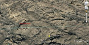
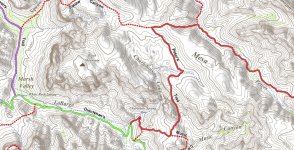
This is a subthread of my post, "DEERING CANYON AND GOOGLE EARTH," to which "alan m" replied, and pointed out an interesting feature in what I call the left fork of Music Canyon. It looks like a natural gouge, GPS 33.45694, -111.33111. See the images below for its general location.
A.jpg

B.jpg

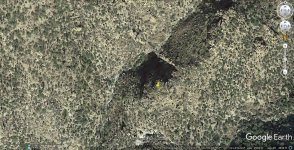
A zoomed view of the gouge is shown below. The gouge is at elevation 2911 feet. I see no dump below the gouge, so I don't see it as a mine site.
C.jpg

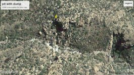
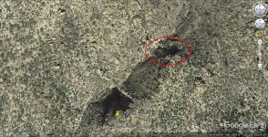
Above the gouge, however, at elevation 2994 feet, is a pit, which is at least partially back-filled. There is a dump below this pit, so I see it as a mine, or prospect site. Pit GPS 33.457593, -111.330471. The pit measures about 45 feet across. It's enclosed in a red ellipse.
D.jpg

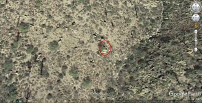
Farther up what I call the left fork of the canyon is what could be a collared mine shaft, elevation 3016 feet, GPS 33.458553, -111.330282. The collared shaft measures about 5 x 6 feet.
E.jpg

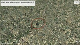
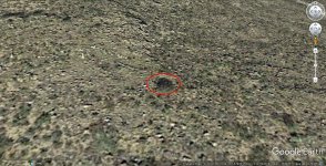
Above the canyon, on the flat, is a very unusual feature, elevation 3574 feet, GPS 33.470732, -111.334714. I see it as a shaft, partially covered over by criss-crossed timbers. It's about 9 feet wide.
F.jpg

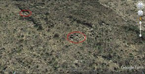
Below are two more unusual features, again above the canyon, on the flat. One feature somewhat resembles a tent. It has straight walls, and a slightly pitched roof. It's enclosed in an ellipse, lower right, elevation 3464 feet, GPS 33.464489, -111.333396. It's about 5-1/3 feet wide.
The other feature is a complete unknown. There also could be ruined stone walls just beyond, and behind, the tent-like object.
G.jpg

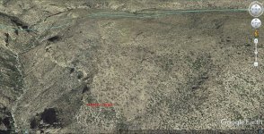
The image below shows Peter's Trail to the right of Charlebois Canyon.
H.jpg
 

I viewed the location of the sixth picture down in your thread on Google earth then I rotated the view
so that the "N" on the compass was pointing about to the southwest and then changed the view date
to "2017" I then took a shot of this image.
This is just my opinion but I don't think that is a shaft. I am not here looking for trouble I am just trying
to be helpful.

shaft, partially covered.jpg
 

You're right. In your screenshot, I see a bush, and a few rocks, inside a shallow depression. The criss-cross pattern of "timbers" has disappeared. The depression might seem to be ringed by stones, but I'm sure that's only an optical illusion. Thanks for your reply. BTW, my screenshot of the pit with dump below might seem like a dumb place to dig a mine/prospect, and it is, being at the bottom of a canyon, where water runoff is funneled down to the drainage channel and the pit, but I've seen dumber things done here in the desert and mountains of Mohave County, AZ. In my desert wanderings, I've seen examples of a lot of effort expended on useless holes.
 

You're right. In your screenshot, I see a bush, and a few rocks, inside a shallow depression. The criss-cross pattern of "timbers" has disappeared. The depression might seem to be ringed by stones, but I'm sure that's only an optical illusion. Thanks for your reply. BTW, my screenshot of the pit with dump below might seem like a dumb place to dig a mine/prospect, and it is, being at the bottom of a canyon, where water runoff is funneled down to the drainage channel and the pit, but I've seen dumber things done here in the desert and mountains of Mohave County, AZ. In my desert wanderings, I've seen examples of a lot of effort expended on useless holes.

Skyhawk

If someone has dug the Music Mountain area, maybe was looking for the Indian grave which has few kilos of gold buried in it. See, the most targets which were given away in the past, were given by Indians who were talking too much.
Many of those targets had accurate clues and many didn't. I believe the clue for the Music Mt. was " close to the trail and right from a ravine of this mountain ". But which trail and which ravine? A general description used by the Natives to save their souls, considering how talking in this manner they would not give away the exact spot and this is like they have said nothing.

Marius,

Is it possible to tell us your source for the highlighted comment above?

Happy New Year!

Joe
 

Marius,

Is it possible to tell us your source for the highlighted comment above?

Happy New Year!

Joe

It's not possible Joe. Maybe you have to find an old timer who dug the place and to ask him his source. But I doubt there remained anybody to tell something about.

Have a Happy New Year too.
 

Just another insight Joe: people who dug around Music Mt. along LaBarge, were after the Burns source of gold. He was privileged enough to possess some gold items from a treasure in the Superstitions and some gold ore from Gonzalez/Haywood mine, gold given to him by an old Indian renegate. Burns also buried his old Indian friend in the Music Mt. with a small amount of gold items at the request of the deceased.
But you know, the gold and the cough is hard to hide, and many " professional " treasure hunters started pushing on Burns for the gold source. And with all these, Burns only escape was to lie about and to leads people to search around his ranch and in the upper LaBarge Canyon box.
Maybe after Burns death, his wife was pushed more for info, info which maybe lead others more north in LaBarge.
 

I have 18 targeted , 14 large and 4 very large ones, my readings are from the trail head , my targets are about two miles in, these readings are Process gold, but other readings are natural gold must be the mines in the area. You can contact me if you’re serious about going with me, my equipment as long range And is proprietorial. Currently involved with Universal Studios with my group in Florida called the real treasure hunters will be filming 10 episodes this spring show is supposed to come out in September
 

Dowser --

Is the proprietary device you're using similar to, or the same as, this one?

Gold Legend.png


This device is advertised as having a maximum range of 3,000 meters (over 2 miles).
 

As someone who has Hiked Music twice and Trap three times, there is a lot to still uncover up in those canyons, honestly a lot. I have had my eye on that area for almost 15 years. Getting my lazy butt back into shape recently and planing a hike back out once weather permits. Ive screenshot the GPS and will try and get photos if possible Skyhawk.
 

Thanks for your reply Absurd-Ginger. I have several more sites pinpointed with GE that might be of interest to you, but I'd prefer to do that show-and-tell by PM. As you're probably aware, GE is far from reliable in displaying things as they really are, so any images that I send must carry with them the warning, "USE AT YOUR OWN RISK."
 

This is a subthread of my post, "DEERING CANYON AND GOOGLE EARTH," to which "alan m" replied, and pointed out an interesting feature in what I call the left fork of Music Canyon. It looks like a natural gouge, GPS 33.45694, -111.33111. See the images below for its general location.

View attachment 1782991

View attachment 1782992

A zoomed view of the gouge is shown below. The gouge is at elevation 2911 feet. I see no dump below the gouge, so I don't see it as a mine site.

View attachment 1782994

Above the gouge, however, at elevation 2994 feet, is a pit, which is at least partially back-filled. There is a dump below this pit, so I see it as a mine, or prospect site. Pit GPS 33.457593, -111.330471. The pit measures about 45 feet across. It's enclosed in a red ellipse.

View attachment 1782995

Farther up what I call the left fork of the canyon is what could be a collared mine shaft, elevation 3016 feet, GPS 33.458553, -111.330282. The collared shaft measures about 5 x 6 feet.

View attachment 1782996

Above the canyon, on the flat, is a very unusual feature, elevation 3574 feet, GPS 33.470732, -111.334714. I see it as a shaft, partially covered over by criss-crossed timbers. It's about 9 feet wide.

View attachment 1782997

Below are two more unusual features, again above the canyon, on the flat. One feature somewhat resembles a tent. It has straight walls, and a slightly pitched roof. It's enclosed in an ellipse, lower right, elevation 3464 feet, GPS 33.464489, -111.333396. It's about 5-1/3 feet wide.
The other feature is a complete unknown. There also could be ruined stone walls just beyond, and behind, the tent-like object.

View attachment 1782998

The image below shows Peter's Trail to the right of Charlebois Canyon.

View attachment 1782999
SkyHawk1251

You are onto something - if you haven't already found an outcrop. Check out Loc: 33°27'05"N 111°20'14"W. This area was recently mentioned (2023), seeing Quartz float down in the gulch of the NW corner of Music Mountain. Happy hunting...
-SpartanOC
 

Top Member Reactions

Users who are viewing this thread

Back
Top