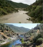
Mother Nature Shows Why Anti-Dredging Laws Are Ridiculous

DizzyDigger

Gold Member
Dec 9, 2012
6,354
12,884
Concrete, WA
Detector(s) used
Nokta FoRs Gold, a Gold Cube, 2 Keene Sluices and Lord only knows how many pans....not to mention a load of other gear my wife still doesn't know about!
Primary Interest:
Prospecting
And it only took a few days of good rain to do it...

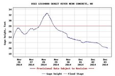
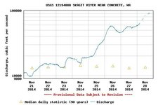
This graph is from today (11-28-2014) and was measured at 19:15 PST.
The current flow in the Skagit River is 91,300 Cubic Feet per Second.
USGS.12194000.01.00060..20141121.20141128.log.0.p50.jpg

Currently 4ft. over flood stage, we're all hoping the river has crested.

This river runs behind my home, and it typically flows at about
12,000-18,000 CFS..except when the heavy rains come in the
Spring and Fall. With all that water flowing off the mountains the
river will generally swell to 50k-60k CFS, and when that happens all the
mud and silt gets washed into the river, too. Water looks like fast-flowing
chocolate milk, but it's also full of debris.

Over 80k CFS and the river starts carrying down trees and
massive logs, huge stumps and plenty more mud.

You can smell the silt in the air. The logs and whole trees grinding
downriver just get larger, and heavier, and like icebergs only a part
shows above water...the rest is dragging along the river bottom,
grinding up everything in it's path. The years salmon runs are just
finishing, and the river is loaded with salmon and steelhead eggs.
Water logged stumps with 120' trees attached to them are oblivious
to the salmon redds...they just grind them up along with the rest of
the bottom material. If you are near the river you can literally feel
the ground shudder as ten tons and 80' of soggy log slam into
boulders the size of a D10 Cat. Tens of thousands of yards of
gravel get redistributed as channels are dug out in one spot
and bars are created in new locations somewhere downriver.

The structure of the entire river is being "renovated" by Ma Nature;
she's not real timid about it. At the same time the ridiculous arguments
of the anti-dredging crowd are being ripped to shreds. The outflow of
a thousand 6" dredges running all year wouldn't make a pimple on the
arse of what Mother Nature did with some rain and melted snow in just
a couple of days.

Ma Nature could care less about "Sue and Settle", or responding to
the inane, endless attempts from the "Church of Save the Earth",
whose dogma is based on their version of a perfect dream world that
simply does not exist, nor will it ever.

p.s. It is currently about 35F, and clear skies. If it stays
cold and clear for a few days, the river will have returned
to it's beautiful, deep clear green normal self.
 

Last edited:
Upvote 0
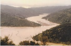
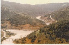
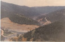
Here are a few pics of a good flood at the Confluence of the American.
Here is a picture of No Hands at regular level and at beginning flood.
no hands.jpg

Then here is a pic with No Hands Bridge totally under water along with all of the rest of the bridges. Notice hwy49 disappearing into the river.

IMG_0005.jpg

Then after the water has receded somewhat and 49 has been washed out.

IMG_0004.jpg

And here after the flood is over and the new road has been built.

IMG_0003.jpg

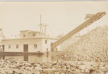
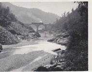
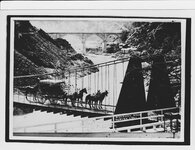
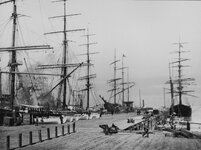
And a couple more pics of some old time fun

IMG_0007.jpgIMG_0006.jpgIMG_0001.jpgSanFran Warf 1900.jpgView attachment San Fran 1851.bmpNugget Spanish Dry Diggins 201.44oz.jpgView attachment Away To California.bmpView attachment Sutters Mill.bmp
 

Those are some great old pics Reed...:icon_thumright:

Our home is located on what's known as "high bank", meaning
we are considered as safely above the highest flood level. In
2003 we had a huge flood that was high enough to reach the
lower terrace of the back yard..it was a strange sight seeing
100' trees flowing by within' 50' of the house...
sSig_aaarggh.gif~original


The past 2 days have been warmer than normal, humid and
very wet...and as I write this it's...snowing. :censored:

Can't wait to see what it looks like when daylight comes. All that
heavy rain has the ground absolutely saturated, and now it's
snowing with clear weather forecast. Temp's will drop to mid-teens,
so everything is going to freeze over.

That makes for real bad ju-ju when that ice melts; perfect
conditions for serious landslides. I'm only 10 miles from Oso,
as the crow flies, and we've had enough falling hillsides for awhile.
 

You are all describing a major form of erosion. Erosion is/has always modified the surface of this planet. Almost everything we see is a result of erosion. Unfortunately "the human butterflies of today" sitting on the "giant sequoia tree" (earth) are clueless.....as they have been here all their lives and have not see the planet change. And when such changes occur (even climate) they scream bloody murder.

Bejay
 

Great old pics Reed but I always lust for them monster sized bucketline dredges. I want to run 1 before I die. Wonder if I could pay Tony Beets in AK to let me run his for any price as definately on the bucket list. Must do before bottom rusts out. High water is indeed a instructional tool to help figure out who,what, where and how things flowed prior to dams. I run around in downpours taking videos for future reference and paid off BIGTIME dozens of times as rivers change into earth moving free flowing objets capable of mass destruction-John
 

Reed, those are great photos! Must have been the big '97 flood, or the '86 flood, when HellHole Dam burst. Right?

Hoser is 100% spot on. Take a lot of photos at the minimum drought river level for comparison to major flood level photos, and you can learn a lot about deposition of gold and gravel for future reference. Even in one season, you will see quite a few changes, from year to year. Studying hydrology is very interesting, and I have a few good books on it, Jeffery Mount is the reknowned expert on hydrology, even with his anti-mining bias. The low sheet flow fine gold sluice idea was lifted from books about sewage and water treatment plants and fluvial processes.

I love big floods! I was flooded out twice in the winter of '74 on the Russian River in Guerneville, CA when the river crested at 43 feet. I was in the big Santa Cruz flood of '81, which tore the San Lorenzo and Soquel rivers a new one, when a Pineapple Express storm from Hawaii, dumped 23" of rain in the S.C. mountains and caused billions in damage.Lo, and behold, I actually discovered a new gravel bar in the Soquel river which was loaded with gold laden quartz gravel after the storm. Which was quite odd, because its all sandstone and clay on that river. The flood had eroded an ancient river channel that came into the main river at a 90 degree angle that dropped the gold. I took 3 buckets of pea sized gravel out but could do nothing with it as I couldn't locate a chrusher. Every piece had large gold flecks in it, but i dumped it behind a house I had to vacate years later. I always wanted to go back to it, but now the river is overgrown with trees and brush, and its a 200 mile drive to get there.

Oh, well!
 

Well we'd better hope that the "Greenies" don't figure out who is really to blame. If they do, next thing we'll be seeing is them trying to serve Mother Nature a subpena to appear in court because they're filing a suit against her!

There was a series of articles in the ICMJ journal a while back of some guy that photographed and videotaped an area he was working with his dredge. He then worked it in a grid and recorded how much he got on a map he had drawn up of the area. He worked it grid by grid and when he was finished he published the results. It made for a very interesting read as it proved that the points of low pressure are where the gold is going to drop out of the flow.

Those of us out here in the desert can also use observations like this to help find the areas of low pressure. Just don't try to make your observations from the bottom of the wash! Yes... it means going out and playing in the Monsoons, but it can really pay off once things dry out. Plus we usually don't have to wait all that long for the water to disappear... ;)
 

Reed, those are great photos! Must have been the big '97 flood, or the '86 flood, when HellHole Dam burst. Right?
[/B]

Yup 1964 - A heavy rainstorm in December 1964 sent a 25-foot-high surge of water down the middle fork AmericanRiver after the partly completed Hell Hole Dam failed. I grew up on Aeolia Drive right above the ASRA station and when the bridge went it woke up everyone. The sirens went off, my dad got the Rescue call to search for survivors and the next day he drove us kids down the old road out of the olive orchard, which is gated now down below the blockade at the top of the hill. All of us kids in the neighborhood walked down to the river and watched all of the clean up going on from up on the old Stage Coach Rd. Then I was also at the dedication of the new bridge when they cut the ribbon :) Good memories :)
Also°°°
- The Rucky-A-Chucky Bridge in Greenwood, upstream from the confluence, was destroyed

- The Highway 49 bridge at the confluence took the full force of the Dec. 23, 1964, surge and washed out

- No Hands Bridge was used as a vehicle crossing over the American River until the new bridge was completed in spring 1965

Many of you will know where this old flood pic is taken from but take a guess and I will post the answer in a pic later.

IMG.jpg

Then here's a few more well known old pics
Bowman Lake 004.jpgminer Aub rav.jpgRockey Bar 1915 Placer co.jpgAuburn Ravine.jpg
 

Great old pics Reed but I always lust for them monster sized bucketline dredges. I want to run 1 before I die. Wonder if I could pay Tony Beets in AK to let me run his for any price as definately on the bucket list. Must do before bottom rusts out. High water is indeed a instructional tool to help figure out who,what, where and how things flowed prior to dams. I run around in downpours taking videos for future reference and paid off BIGTIME dozens of times as rivers change into earth moving free flowing objets capable of mass destruction-John

Amen Hoser, I would give valuable body parts to spend a season on a bucketline. I watch with great anticipation while Tony tries to get that one going.
When I was a younger I had the good fortune to play around on a working cutterhead dredge in Montana. My step dad was chief engineer so he would let me spend some of my summer days on-board doing light work for no pay. lol Amazing machine 6' diameter cutter head, 24" suction pipe and it would just eat railroad ties and tires without a blink. I will see if I can find a couple pics I have somewhere
 

Great Pics Reed. I think the diving bell one is around the corner below Mineral Bar bridge somewhere in the 20's or 30's.

Mike Hope all that mud,sludge and debris will deposit a nice streak of gold for you if your still chasin it.
 

Millions were taken out of Drivers Flats campground where the old bridge went down in that flood. It acted like riffles in a sluicebox and monster nuggets MUCH bigger than potatoes found there by the folks I sent there. Ray ended up campground host and spent years pulling over a 100 lbs from that stretch up to Antelope creek. Deep,dark and dangerous and a few boulders bigger than greyhound bus held a monster 2 1/2 lb slab and 1,000s of his brothers.There were 4 -4/ 55 gallon barrel winches,3 griphoist underwater and only got that thang a few inches off the ground,just enough to move and YAHOO bloody eureka. That flood gold sure piled everything up along with cars,tractors and such road working equipment from a project upstream. Great info Reed-John
 

I read somewhere that all the mining operations on the planet only moved one percent of the total material that Mother Nature moved each winter. Of course the eco nazis will probably come up with some lame excuse to explain their illogical position.
 

We've now had several very clear, cold days and the river
has dropped back to it's normal flow for this time of year.

USGS.12194000.02.00065..20141126.20141203..0..jpg

Instead of the water being the color of chocolate milk, the
silt/mud has re-settled, and there's nearly 8' of visibility
now.

Even better is that I saw a few Chum Salmon rolling
in the back eddy below the house, so they will be dropping
eggs that will survive.

For those not familiar, there are several kinds of salmon.
We get Kings, Pink's (aka: 'Humpies), Coho (aka: Silver),
Chum (aka: Dog Salmon) and finally Sockeye.

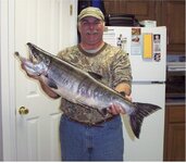
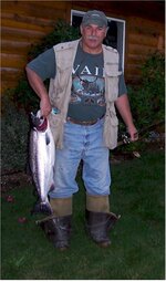
Here's an average Chum I caught a few years back. They
aren't much good for the BBQ or table, but they taste
tremendous when smoked. Of all the salmon I think the
Chum makes the best smoked.

Chum 112005.jpg

A decent Coho (best on the grill or table)

Mike COHO 092606sssss.jpg

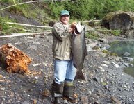
And just for fun, here's a 38 lb. King I caught about 9 years
ago out on the legendary Hoh River:

Mike with his Springer King.jpg

We'll know in 2-3 years if the flood this Fall did serious
damage to the redds, as the returns will be low. Don't
think we lost too many, as this river has had these high
flows every year, and sometimes more than once.

The people who think we damage the river are simply
tilting at windmills.
 

Nice fish! :icon_thumright: Are any species on the endangered list up there?
For a while we could only keep hatchery Steelhead.
I'am getting geared to spend some time on the Rogue, A friend and I getting a jet boat....then we can go 50+ miles upriver. Did I mention, nice fish?:laughing7:
 

Here's an example of the Yuba's "normal" and yearly purge mode. Note: not my photos.

South%20Yuba%20River%20bridge.jpg

11927373.jpg


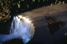
Here's what Lake Englebright looked like during a flood:
englebright_spillway-1997_flood_3.jpg

By their own rules the water board has outlawed nature!
 

Sounds like Tony Beets could make a fortune just running a tourist op for us ol'farts who are dying to get behind the controls of a REAL DREDGE :occasion14: That gravel munching monster is indeed a destination I would get to no matter what the cost,financial or personal agony-John
 

I just don't get it. :icon_scratch:

How can any sane, logical person say that using a dredge
causes all kinds of heinous damage to a river or stream when
Ma Nature's annual "clean-up" tops it by 10,000 fold.

WHY hasn't some attorney gone in, showed the
court the "before" and after" pics of these annual flood events?
Show how the high water flows move material around in the
river, show a few cow sized boulders rolling along with the
floodwater, and explain how the river will move/relocated tens
of thousands of yards of river bottom.

"Your Honor, dredging a river with an 8" hose wouldn't make
so much as a pimple on the ass of the annual flood. If the
Plaintiff's wish to sue Mother Nature then that's their business,
but my clients (dredgers in the state) are completely innocent
of the presumptions and accusations of the Plaintiff's".


It'd be damn tough for the Eco-warriors to stand in front
of those pics and still accuse us of damaging the river system.
They'd look like complete idiots if they still attempted to
rationalize stopping dredging based on their weak arguments.

Should be simply: "Case Closed".
 

Top Member Reactions

Users who are viewing this thread

Back
Top