pa-dirt_nc-sand
Silver Member
I find myself watching any treasure/outdoor adventure show in the evenings to unwind. Discovery, Nat Geo, A&E, etc. Lately I’ve been interested in the amazing discoveries Albert Lin finds using his LIDAR drones. The LIDAR strips away the jungle canopy to unveil lost Mayan cities.
I had looked into online LIDAR maps before for my county, but could only find Topo quality ones that you could not zoom in and see any real details. So I looked into buying a LIDAR drone, but they are crazy expensive, like Deus money...
I did some more online searching last week and found a link from Penn State with highly detailed LIDAR maps, including Allegheny County and Philadelphia.
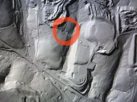
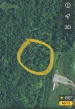
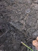
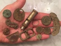
Met a buddy to see if we could find this old road cut in the park woods and find the cellar hole at the end. We swung our way to where the road should be, lots of marshy ground (the worst) and tons of briars, but finally found the remnants of a cut limestone block foundation. About 25% of this area was swingable and we started finding some old coins and relics. Nothing amazing, but some oldies and keepers.
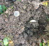
1824 Large Cent in the road right before the cellar.
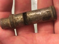
Municipal Police whistle
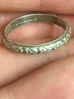
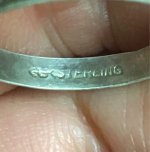
Uncas ring from early 1900’s.
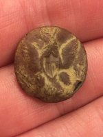
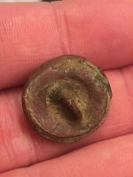
Surprised to find a CW Eagle Button (I believe), you never know what will pop out.
Here is the handful.
The LIDAR link is a fun new tool to use along with other mapping links to better select new sites for exploration.
Good luck out there!
I had looked into online LIDAR maps before for my county, but could only find Topo quality ones that you could not zoom in and see any real details. So I looked into buying a LIDAR drone, but they are crazy expensive, like Deus money...
I did some more online searching last week and found a link from Penn State with highly detailed LIDAR maps, including Allegheny County and Philadelphia.


Met a buddy to see if we could find this old road cut in the park woods and find the cellar hole at the end. We swung our way to where the road should be, lots of marshy ground (the worst) and tons of briars, but finally found the remnants of a cut limestone block foundation. About 25% of this area was swingable and we started finding some old coins and relics. Nothing amazing, but some oldies and keepers.

1824 Large Cent in the road right before the cellar.

Municipal Police whistle


Uncas ring from early 1900’s.
Surprised to find a CW Eagle Button (I believe), you never know what will pop out.


Here is the handful.

The LIDAR link is a fun new tool to use along with other mapping links to better select new sites for exploration.
Good luck out there!
Upvote
28


