How to find old mines, tailing piles, forgotten/lost mines

Just_curious

Sr. Member
Aug 27, 2017
332
273
Georgia/Alabama
Detector(s) used
Minelab GM1000
White's GMZ
White's Spectrum XLT
Primary Interest:
All Treasure Hunting
Hi everybody, I've had absolutely zero luck with my prospecting and beginning to think I'm in the wrong spots. This is hard for me to believe though because I plotted all the claims in GA and AL and followed the trends/patterns. I have yet to stumble upon any old mine shafts or tailing piles. If anybody has some advice on this, I would love to hear it. I just bought a GM1000 so I really want to start getting after it and finding good spots and gold

Also, just out of curiousity, does anybody have any information/leads on old cherokee or Spanish mining in Georgia? Like prior to Indian removal. Probably around the 1500s and 1600s? Or any leads to forgotten/lost mines from the 1800s? Thanks in advance. This is extremely difficult because all the areas appear to be private property, and all the public land doesn't have any history of gold, in addition to that, the info I pulled from minecache and other sites don't tell me if the claim is from past or present. The properties in GA and AL are difficult because they are all owned, and from what I can tell, the BLM doesn't handle the claims here.

Sent from my SAMSUNG-SM-G891A using TreasureNet.com mobile app
 

Upvote 0
There are no claims in Alabama or Georgia, there never were any claims there. The BLM wasn't even created until 1946 and had nothing to do with mining claims until 1976. The Mining Act permitting mining claims on public lands wasn't enacted until 1872.

The mines are all private property. If you want to prospect in Alabama or Georgia you need to either pay someone, buy the property or get permission from the property owner. The vast majority of the mines in the area you are researching were coal, limestone, copper and iron mines. Gold is rare and so are gold mines.

Alabama keeps a record and map of all the mines in the State. The Alabama Dept. of Labor, Inspections Division, Abandoned Mine Land Program, Alabama Mine Map Repository is where you will find those maps. I imagine Georgia has something similar.

The Cherokee did not live in the Georgia gold areas before 1700. The Spanish left Georgia 120 years before gold was discovered there. The Spanish only had settlements on the coast and were forced out of Georgia by Oglethorpe (British) by 1680. There were never any Cherokee or Spanish gold mines in Georgia or Alabama.

I wish you luck in your prospecting. If you put aside the misconceptions you have about the mining history of the area and concentrate on the gold mineralization and gaining access to a likely area I think you will find what you are looking for much sooner. :thumbsup:

Heavy Pans
 

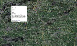
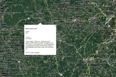
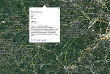
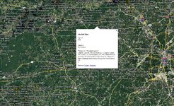
Google Earth says there are many mines in Georgia, the yellow dots are more likely to be precious metals.
georga.jpg 9-28-2017 6-04-57 PM.jpg 9-28-2017 6-05-51 PM.jpg
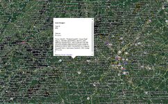
In another post you also asked about Alabama
alabama.jpg alabama2.jpg
from what I can see there is a large band of where Gold is found in your area, always ask permission for private land
 

Last edited:
That's pretty cluttered with "other" mines. Here's a map with only gold mines and prospects. It makes it a lot clearer which areas have produced gold.

Turn on the Topo or aerial base layer to get different maps of the same area.

Heavy Pans
 

Bc, what plug-in is that? I've been using minecache, but yours looks like it has alot more. Also, the major issue is that there is no such thing as public land in GA or AL. Thanks for the advice everybody.

Sent from my SAMSUNG-SM-G891A using TreasureNet.com mobile app
 

Its Barrys' plug in.

as far as rock stacks (often called tailings) pit's ditches ,cuts, diggings, scrapes, prospects,adits, portals shafts...

You do have the right idea. Once you get an eye for it you will see the out of place and unnatural lines.

Nature has very few straight lines.

The south has a pretty humid environment. so, things can rot and get buried quicker...But, I can tell you that I have come across things in the desert and forested hills that have sat for a hundred and fifty years and have rusted or grown moss but, you can surely tell man was there. They also lokk like they have been there no more than fifty years.

Sites that were worked significantly show it for a long long time.

The type of thing dug can affect the way it was dug. Close to moving water and piles of rounded rock tend to mean gold was being hunted.

If they were chasing a certain type of vein you can figure out maybe what they were after by learning about the waste rock they left behind.

those "throw out" piles are where your likely to find bits of what they were looking for.

They "missed" a lot that they actually dug out and they didn't get to a lot of what was there.

you definitely want to narrow down your search to where there were known gold mines
 

I feel confident i could identify them if I see them. I am in the military and know all about terrain association, natural v man-made, etc....the problem is actually finding them. I did happen to find an underground mine that hasn't been in operation since 1909, but I haven't personally been up there yet. I don't know if I will be able to get to it. All property is private or federally owned here.

Sent from my SAMSUNG-SM-G891A using TreasureNet.com mobile app
 

Yes it is cluttered, so he can get the big picture of mines in both states. When I was in the military the only terrain association I received, was "Go north over the hill" problem was it was usually dark and the hill was about 10 miles away and we had 50 lb packs
To find old mining districts you can start with books, I'm sure there are local prospecting or metal detecting clubs in your area. Google "mineral resources kmz file" and install it in google earth.
 

Last edited:

Top Member Reactions

Users who are viewing this thread

Back
Top