How or where to find lat/lon coordinates in old online maps

We used to overlay using ArcGIS years back by setting different transparencies on different maps like the old channel maps. It was pretty neat but these days we just have different maps set on different levels that you can just choose from. The old maps are nice, but no where near as accurate depending on the version. Plus, I've gone back to using the Garmin GPS mostly because of the ease of use. If you know the area, just overlay the maps and triangulate your coordinates, throw them on Google earth and look around :)
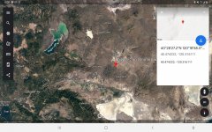
Screenshot_20200826-050936_Earth.jpg
 

Top Member Reactions

Users who are viewing this thread

Latest Discussions

Back
Top