- Jun 26, 2008
- 7,786
- 11,136
- Detector(s) used
- Ace 250 (2), Ace 300, Gold Bug 2, Tesoro Cortes, Garrett Sea Hunter, Whites TDI SL SE, Fisher Impulse 8, Minelab Monster 1000, Minelab CTX3030, Falcon MD20, Garrett Pro-pointer, Calvin Bunker digger.
- Primary Interest:
- Metal Detecting
If you have followed my posts for any amount of time, you will have noticed the emphasis I place on research. Whether you are a gold prospector, relic hunter, or simply a coin-shooter in a local park, it is hard to ignore the history learned of a particular area through research. Not only does it help answer questions but, at the least, it makes the hunt more fulfilling. I direct you to the following picture:

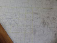
Although very difficult to see, some of this topo is "checker-boarded" with sections (one mile square) for public, private, public, private squares and so on. This is easy to see on a BLM regional map, indicating public lands. Also on this map, notice certain sections that are outlined in blue. A township is a six mile square, containing thirty-six sections. The two bottom blue squares are the 16th sections of each respective township, public land. This is not a coincidence. Back when our new country was surveyed, the government decided that one section of each township was to be reserved for school (educational) purposes. This was the 16th section. Because of large amounts of city expansion in the east, many of these "school" sections no longer exist. But some still do in the western U.S. How did these public/private sections come to be? Back in the 1800's, our expanding country had a whole bunch of land out west but few people would buy this land because it was in the middle of "nowhere". How would an owner get his produce or livestock to market? Enter the expanding railroad! The U.S. made a pact with the railroad. If they would lay track, they would get land to sell to defray the cost of laying the rr lines. To keep the rr's from picking only the best sections, the government made them "checker-board" the sections they would own. These became railroad property (private) to sell. Now, the land became more attractive to buyers as the rr's now would get the farmer's product to market. This checker-boarding still exists today. Now.... as they say.... you know the rest of the story. Research! ╦╦Ç

Although very difficult to see, some of this topo is "checker-boarded" with sections (one mile square) for public, private, public, private squares and so on. This is easy to see on a BLM regional map, indicating public lands. Also on this map, notice certain sections that are outlined in blue. A township is a six mile square, containing thirty-six sections. The two bottom blue squares are the 16th sections of each respective township, public land. This is not a coincidence. Back when our new country was surveyed, the government decided that one section of each township was to be reserved for school (educational) purposes. This was the 16th section. Because of large amounts of city expansion in the east, many of these "school" sections no longer exist. But some still do in the western U.S. How did these public/private sections come to be? Back in the 1800's, our expanding country had a whole bunch of land out west but few people would buy this land because it was in the middle of "nowhere". How would an owner get his produce or livestock to market? Enter the expanding railroad! The U.S. made a pact with the railroad. If they would lay track, they would get land to sell to defray the cost of laying the rr lines. To keep the rr's from picking only the best sections, the government made them "checker-board" the sections they would own. These became railroad property (private) to sell. Now, the land became more attractive to buyers as the rr's now would get the farmer's product to market. This checker-boarding still exists today. Now.... as they say.... you know the rest of the story. Research! ╦╦Ç


