great ridge

rgb1

Sr. Member
Nov 24, 2013
295
769
s.w. Ohio
Detector(s) used
2 whites 1 garett
Primary Interest:
All Treasure Hunting
hay guys here is something i looked at i do not believe the great ridge is pine mtn. if you go to pg. r on forum bottom of page thread by boomer yep another swift waybill ki posted 4 maps if the west mines are in red river gorge and i believe they are and they down a great ridge from there it does not make sense to me that they went to pine mtn. from there it is too far away if you look on the maps posted by ki you will see two or three great ridges running to south west i believe one of these is possibly one swift was referring to i have not studied the lower mines this is just the way i look at it mabey im wrong but is a possibility give me your thoughts post by ki page 5 bottom sorry for misdirection its now on pg. 6 at top got grand kids bothering sorry for screw ups
 

Last edited:
I'm with you rgb 1 , I don't think pine Ridge is the ridge referred to in the legends. then too I don't think the Big Gap is Cumberland Gap either. I find a lot of the things that have been posted hard to swallow, and the more research I do the less of it I believe. There is a river that runs through the Blue Ridge Mtns. that would make the biggest gap that I can find.
 

Last edited:
I think the route traveled has been one of the things that has got most people stumped. The thing that sticks n my mind is that they wanted to keep the business of their Company secret . what better way to keep it all secret than to take different routes into and away from the mines ???
 

A bit of information some may not know. When the counties was laid out way back when, It was common place that the county line would run along ridges and or streams/rivers but most often ridges. It is easy to see on a map with county lines outlined on it like google earth .
 

Link to thread rgb1 is speaking of.
http://www.treasurenet.com/forums/l...428-yep-another-swift-waybill-part-1-2-a.html

perhaps a topo map of the region South of the RRG would help? Those older maps have a way of being skewed badly...

this link goes to a topo map with the RRG in the North/top of map and Campton center-right. You can recenter the map or zoom in and out to explore for a 'great ridge'. Several creeks including Lower Devils Creek run North-South and empty into the KY River.

https://www.topoquest.com/map.php?l...ad83&zoom=32&map=auto&coord=d&mode=pan&size=m
 

Last edited:
Someone posted it the thread you refer to that 70 miles put you at Allen. If you take the crooks in the river into consideration the 70 miles will put you right at the mouth of Paint Creek. Traced it out with google earth. 70 miles is highway distance.
 

Never give thought to the fact he might have went up the Tug. Didn't trace it out.

Usually the journals say Southwest along the Great Ridge...Tug is almost Southeast. Doesn't mean they didn't go that way...lots of ways to lead readers astray.
 

Someone posted it the thread you refer to that 70 miles put you at Allen. If you take the crooks in the river into consideration the 70 miles will put you right at the mouth of Paint Creek. Traced it out with google earth. 70 miles is highway distance.

When was Paintsville lake built? You need a modern map prior to it being built, probably early 1960s would do.

Here is a link to 1859 map you can zoom on

http://www.historicmapworks.com/Map...APSdigobj3562/Kentucky+1859+Eastern/Kentucky/

1880s map of several counties in that area

http://www.historicmapworks.com/Map...oyd+-+Martin+Counties+188x+Wall+Map/Kentucky/
 

Last edited:
Why do I need a map of a place I use to fish on a very regular bases before it was dammed up and made into a lake in 77/78 ??? The thing I speak of about Paint creek are from things I saw while fishing it years ago, Not map or hear say. I have a map of it though, it's a topo map that has about 35 pages each page larger than a legal pad from the COE .
 

Last edited:
Link to thread rgb1 is speaking of.
http://www.treasurenet.com/forums/l...428-yep-another-swift-waybill-part-1-2-a.html

perhaps a topo map of the region South of the RRG would help? Those older maps have a way of being skewed badly...

this link goes to a topo map with the RRG in the North/top of map and Campton center-right. You can recenter the map or zoom in and out to explore for a 'great ridge'. Several creeks including Lower Devils Creek run North-South and empty into the KY River.

https://www.topoquest.com/map.php?l...ad83&zoom=32&map=auto&coord=d&mode=pan&size=m

If your looking for a long ridge running SW you need 2 parallel streams running the same direction....
 

Why do I need a map of a place I use to fish on a very regular bases before it was dammed up and made into a lake in 77/78 ??? The thing I speak of about Paint creek are from things I saw while fishing it years ago, Not map or hear say. I have a map of it though, it's a topo map that has about 35 pages each page larger than a legal pad from the COE .

Sorry I thought the thread spoken of was tracking up to Paint Creek. A modern map would reveal more 'detail' and would not have as much skew to it and random Mts drawn about it looking like long ridges...
 

Lot of details left off the map at the link. No elevation lines and lots of other details missing. Not a problem though. I prefer historic aireal maps when I go back to the 1700 /1800's most of them go back to the 1800 but loaded with info. Found a plantation that some of my kin folk owned back in the 1800's on them. Sometimes
 

Last edited:
Lot of details left off the map at the link. No elevation lines and lots of other details missing. Not a problem though. I prefer historic aireal maps when I go back to the 1700 /1800's most of them go back to the 1800 but loaded with info. Found a plantation that some of my kin folk owned back in the 1800's on them. Sometimes

? need to finish a thought?
 

There are ridges that run far enough that Swift could have easily called them a great ridge.

...or The Longridge as in Timmins version of of the Journal stated.

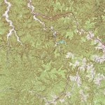
rgb1 here is a candidate just South of Natural Bridge State Park called Big Bend Ridge. It stretches toward the SW and looks to be a few miles long.

https://www.topoquest.com/map.php?l...nad83&zoom=8&map=auto&coord=d&mode=pan&size=m

SouthOfNaturalBridgeSPTOPO.jpg
 

Last edited:
...or The Longridge as in Timmins version of of the Journal stated.

rgb1 here is a candidate just South of Natural Bridge State Park called Big Bend Ridge. It stretches toward the SW and looks to be a few miles long.

https://www.topoquest.com/map.php?l...nad83&zoom=8&map=auto&coord=d&mode=pan&size=m

View attachment 1682421

The maps Ki posted in the thread mentioned was not of RRG., They were of the Sandy region. Considering the legends say they split up at the fork of Sandy and one group went S.West down a long ridge and the other group went west. What does this map have to do with the subject ???
 

Last edited:
The maps Ki posted in the thread mentioned was not of RRG., They were of the Sandy region. Considering the legends say they split up at the fork of Sandy and one group went S.West down a long ridge and the other group went west. What does this map have to do with the subject ???

Pine Mountain Ridge is the long ridge laying SW as it divides Virginia from Kentucky all the way down to where it divides Kentucky and Tennessee.
 

Top Member Reactions

Users who are viewing this thread

Back
Top