Google Earth and the Minas del Oro treasure map

somehiker

Silver Member
May 1, 2007
4,365
6,434
Primary Interest:
All Treasure Hunting
Rather than interrupt Jack H.'s "Map 33" thread, I will re-post the "Minas del Oro" map here for those who may wish to use Google Earth as a virtual means to search for the gold.

Treasure Map Facsimile

If one considers the possibility that the main watercourse has been mistakenly ( or perhaps misleadingly ) labelled "Rio Salado" on this map, and that the river shown may actually be the Gila River, then "Campo Mayor" may also be "Casa Grande".
The Campo Mayor, as drawn on the map, is a good representation of the Casa Grande site (buildings,mound,rectangular enclosure and old diagonal trail) . As is it's position relative to the Gila River. The mound is depicted as a doubled rectangle within the Campo Mayor enclosure.
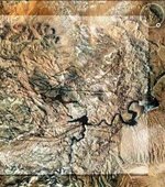
Orient G/E so that West is up, locate both the "Casa Grande Ruins" Northwest of Coolidge and "Pichacho Peak",26 miles to the East/South East, strike a straight line between the two, then scan the area below the line for whatever might be shown on the map.
Reference to a number of the older historical maps and accounts might also be helpful.

Regards:SH.
 

Last edited:
somehiker

I post a part of " MINA DEL ORO " map to see the places who are you interesting . I don't post all the map becouse the " CASA CAVERNA " in the map show the place of LDM .

Part of MINA DEL ORO map verification.jpg

Marius
 

No need to, Marius.:laughing7:
You can meet many Dutch Hunters around Bluff Springs and Black Top.....even Malapais Mtn.
Many believe it's somewhere on or near by.
But many caves in the mountains have, or once had "casas" inside them.
The task is to recognize which one it is....with a mine tunnel across from it and with pit mine above the tunnel.
And to realize that some of the maps may not apply to the LDM at all.
Or to the Superstition Range.

This is more like what I had in mine......mind.

View attachment map 33.bmp

And Campo Mayor

View attachment Campo Mayor.bmp

Some of the history of this area is discussed here....Lost Dutchman Gold Mine - Arizona Superstition Mountain Wilderness - Gold Mining ? View topic - Twin Buttes Markings

More here....DesertUSA.com/mb3 ? View topic - "RESCUE ON BATTLEAXE ROAD" BY JIM HATT.....

Regards:SH.
 

O.K. somehiker 8-)


I wrote in JackH's thread ( map #33 ) how the " CASA CAVERNA " is not a common cave . Is a " cave " symbol ( a horseshoe ) with a rock cabin ( or " two rooms house " in other clue ) in it . Look this picture

CASA CAVERNA.jpg

You wrote " The task is to recognize which one it is....with a mine tunnel across from it and with pit mine above the tunnel.
"
. The clue who say " The great clew for which all the search is now being made is a rock cabin in a cave,
which, according to “Old Yoccup’s” story, is directly across the canyon from the mine,
and not more than 200 feet from it "
, from my investigation have a mistake . The word " from the mine " is " to the mine " . This mistake being misspelling , or intentionally to confuse the searchers .
As I wrote in JackH's thread ( map #10 ) , the mine is above the tunel .
I respect your opinion and I wish you good luck .


P.S.

The " cave " is a breath away from the " horse " .
Is better to not ignore this " cave " . Maybe is more famous than LDM . Look at http://thelostdutchman.hubpages.com/hub/Treasure-of-the-Cursed-Superstition-Mountains

Marius
 

Last edited:
Marius:

If you read the two links I posted above, and look at the photos, you will see both the horse and the heart on the ridge.
You can also see a cave and a mine which are "a breath away from the " horse ". "
That horse is also on the "norte" side of the Gila River.

Regards:SH.
 

Last edited:
somehiker

I saw the pictures in your link and in my opinion the symbols looks like a lure .
Have the heart the clues of the " Latin heart " ?
Have the " horse " orientation from East to West ( from Santa Fe ) ? In the "Horse " map under the words " AL NORTE DE RIO " is a mark " 3E " who means " change direction " or " turnaround " . This means how the " horse " is South of the river .
In my opinion , the river in the map's clue is smaller than Salt or Gila rivers . The river is spring's runlet .

Marius
 

Last edited:
From : http://freepages.genealogy.rootsweb...wnie Holmes vs James McCarthy - LDM Story.pdf

THE ARIZONA DAILY STAR
TUCSON, ARIZONA, WEDNESDAY MORNING - JULY 22, 1931, Page 5
VOICE of the PEOPLE
Letters to the Editor

"To Tucson also came Peralta and the rest of the survivors of the ambush and here the expedition was made up for another start. Ludy introduced Jacobs to Peralta, and he was invited to become a member of the new expedition. With the expedition this time went two women, Perlata’s niece and the sister of a Yaqui chief, who had accompanied Peralta from Chihuahua. These two had been left in Tucson when the party had left before, but both refused to be left behind this time and Peralta reluctantly agreed to their coming along.
About fifty miles from Tucson, at the junction of the San Pedro and Aravaipa rivers, they were again attacked. This time the situation was partially saved by the reinforcement of a party of prospectors on their way to Yuma with a shipment of gold ore. Only partially, however, for the two girls were captured and carried off by the Apaches. The young chief and a friend followed the band into the Sierra Ancha mountains and the balance of the party pushed on to what is now known as McVey wash, near the Gila river. Camping there that night, they went on the next morning to the Buttes on the Gila, about 13 miles east of the present site of Florence, where they set about making permanent camp which they intended using as a base of supplies for their trips into the mountains after the gold and also they intended to follow the trail of the raiders in the attempt to rescue the girls as soon as the trailers reported. They built a stone cabin and corral, which still stands, and about the time this was completed the chief and his friend returned with the information that the Apaches had split up into small bands and separated, going in several different directions. They decided to go into the mine and get out a packtrain load of gold ore and then to concentrate their search for the girls. They made a hurried trip in and took out what they could carry. On the way to camp they were attacked at Queen Creek and were forced to abandon a part of the gold on top of the north end of Superstition mountain. This was later discovered by two gold camp followers after the discovery of Goldfield."

Regardless of the accuracy of McCarthy's account, he and probably others believed these stone structures to have been built by the Peralta party. If so, they may also have known about the "scrapings". All prior to 1931.
The ruins are still there, on the south side of the Gila and a short distance downstream from the "scrapings".

View attachment Peralta Stone House.bmp

Regards:SH.
 

Last edited:
From : http://freepages.genealogy.rootsweb.ancestry.com/~gcundiff/LostDutchman/ruth/Brownie%20Holmes%20vs%20James%20McCarthy%20-%20LDM%20Story.pdf

THE ARIZONA DAILY STAR
TUCSON, ARIZONA, WEDNESDAY MORNING - JULY 22, 1931, Page 5
VOICE of the PEOPLE
Letters to the Editor

"To Tucson also came Peralta and the rest of the survivors of the ambush and here the expedition was made up for another start. Ludy introduced Jacobs to Peralta, and he was invited to become a member of the new expedition. With the expedition this time went two women, Perlata’s niece and the sister of a Yaqui chief, who had accompanied Peralta from Chihuahua. These two had been left in Tucson when the party had left before, but both refused to be left behind this time and Peralta reluctantly agreed to their coming along.
About fifty miles from Tucson, at the junction of the San Pedro and Aravaipa rivers, they were again attacked. This time the situation was partially saved by the reinforcement of a party of prospectors on their way to Yuma with a shipment of gold ore. Only partially, however, for the two girls were captured and carried off by the Apaches. The young chief and a friend followed the band into the Sierra Ancha mountains and the balance of the party pushed on to what is now known as McVey wash, near the Gila river. Camping there that night, they went on the next morning to the Buttes on the Gila, about 13 miles east of the present site of Florence, where they set about making permanent camp which they intended using as a base of supplies for their trips into the mountains after the gold and also they intended to follow the trail of the raiders in the attempt to rescue the girls as soon as the trailers reported. They built a stone cabin and corral, which still stands, and about the time this was completed the chief and his friend returned with the information that the Apaches had split up into small bands and separated, going in several different directions. They decided to go into the mine and get out a packtrain load of gold ore and then to concentrate their search for the girls. They made a hurried trip in and took out what they could carry. On the way to camp they were attacked at Queen Creek and were forced to abandon a part of the gold on top of the north end of Superstition mountain. This was later discovered by two gold camp followers after the discovery of Goldfield."

Regardless of the accuracy of McCarthy's account, he and probably others believed these stone structures to have been built by the Peralta party. If so, they may also have known about the "scrapings". All prior to 1931.
The ruins are still there, on the south side of the Gila and a short distance downstream from the "scrapings".

View attachment 740491

Regards:SH.

Wayne,

Some years ago I did some research into the "Jacobs and Ludi" story. Here are some interesting records I found:

Name: Jacob Ludi
Side: Union
Regiment State/Origin: Missouri
Regiment Name: 2 Batt'n. Mo. S.M. Cav.
Regiment Name Expanded: 2nd Battalion, Missouri State Militia Cavalry
Company: D
Rank In: Captain
Rank In Expanded: Corporal
Rank Out: Corporal
Rank Out Expanded: Corporal
Film Number: M390 roll 29

_________________________________

Name: Charles Ludi
Side: Union
Regiment State/Origin: Missouri
Regiment Name: 2 Batt'n., Mo. S.M. Cav.
Regiment Name Expanded: 2nd Battalion, Missouri State Militia Cavalry
Company: D
Rank In: Private
Rank In Expanded: Private
Rank Out: Private
Rank Out Expanded: Private
Film Number: M390 roll 29
___________________________

As I recall, they joined on the same day, and were also mustered out together. Their names were, as noted: Jacob and Charles Ludi.

Funny how history and fiction have a way of melding together. As I recall, they were in Tucson.

I believe the stone house ruins you are referring to, was an old stage stop. They would be about where you mention, on the south side of the Gila River.

Take care,

Joe
 

Joe:
You had mentioned the stage stop in another thread on the "battleaxe road" topic on DUSA.
There is an old stage station on the north side of the river however,
Panoramio - Photos of the World
It's above North Butte , on the road from Florence to the Martinez Mine.

However:
This from a Wikpedia article ....Copper Basin Railway - Wikipedia, the free encyclopedia

"At one point on the line, ruins of a guard post on the south side of the Gila River may be seen, left from when the Gila River formed the southern border of the United States before the Gadsden Purchase. A few miles further along lies the foundation from an early stagecoach station, at the only point where the Gila could be forded."

There is no river crossing at the location of the first ruin. Nor is there any "road" which continues beyond the ruin.
But there is a ford just east of the old Cochran townsite, where Cochran Road and Copper Mine Road intersect.
And the deeper ford, which I waded through last year, on the other side of the Buttes.
The "guardpost" reference also places the ruin in the correct time frame,re: the Peralta expedition, as does it's location on the Mexican side of the border.

Regards:Wayne
 

Does this small ruin raise new questions then...and possibly new avenues of research relating to the maps we have available, including the Stone Maps ?
It may.
Does the "Santa Fe" and the 1847, taken to be a date, refer to the occupation of Santa Fe in 1847 by American forces ?
The Americans met no opposition. The Mexican army, after some debate, had fled.
To where, by what route, and did they also carry any "treasures" of Santa Fe with them ?

Regards:SH.
 

Joe:
You had mentioned the stage stop in another thread on the "battleaxe road" topic on DUSA.
There is an old stage station on the north side of the river however,
Panoramio - Photos of the World
It's above North Butte , on the road from Florence to the Martinez Mine.

However:
This from a Wikpedia article ....Copper Basin Railway - Wikipedia, the free encyclopedia

"At one point on the line, ruins of a guard post on the south side of the Gila River may be seen, left from when the Gila River formed the southern border of the United States before the Gadsden Purchase. A few miles further along lies the foundation from an early stagecoach station, at the only point where the Gila could be forded."

There is no river crossing at the location of the first ruin. Nor is there any "road" which continues beyond the ruin.
But there is a ford just east of the old Cochran townsite, where Cochran Road and Copper Mine Road intersect.
And the deeper ford, which I waded through last year, on the other side of the Buttes.
The "guardpost" reference also places the ruin in the correct time frame,re: the Peralta expedition, as does it's location on the Mexican side of the border.

Regards:Wayne

Wayne,

It's been awhile since I looked into the ruins for Greg Davis. As I recall, it was at Donnelly Wash, and there was a ranch by the same name.

Historically, that area has been used for a crossing since the time of Father Kino. No doubt it was used by the natives for many years before the arrival of the Europeans.

As for there being no other crossing, that depends on how dry the year has been.

This from awhile ago:

http://www.treasurenet.com/forums/t...false-arizona-history-without-references.html

Take care,

Joe
 

Last edited:
Does this small ruin raise new questions then...and possibly new avenues of research relating to the maps we have available, including the Stone Maps ?
It may.
Does the "Santa Fe" and the 1847, taken to be a date, refer to the occupation of Santa Fe in 1847 by American forces ?
The Americans met no opposition. The Mexican army, after some debate, had fled.
To where, by what route, and did they also carry any "treasures" of Santa Fe with them ?

Regards:SH.

Wayne,

It certainly does raise some new questions. I don't know if there are any documented answers to be found, but I remain convinced that the Stone (Trail) Maps pertain to the Superstition Mountains, to the exclusion of any other place. Just too many matches to the topographical features......as I have pointed out many, many times.

I have little doubt that they took some treasure with them when they fled Santa Fe. I don't, however, believe it was a vast amount.

Good luck,

Joe
 

Hello my friends,the squares are mining camp sites.many Depending on how large the mine is or group of mines.are extremely large.
 

Hello somehiker you have good photos.look at the one you have squared off in yellow.the square on the right is the one I will talk about.the square is the encampment.look belo you see small black cross a,it is over large mine symbol.below it is a double lined coss look at the black circle tunnel.
 

Hello somehiker you have good photos.look at the one you have squared off in yellow.the square on the right is the one I will talk about.the square is the encampment.look belo you see small black cross a,it is over large mine symbol.below it is a double lined coss look at the black circle tunnel.

I don't think there are any mines or mine symbols within that yellow border.
The yellow only outlines Casa Grande, a major Hohokam ruin near the Gila River.
The layout of the ruin, with it's perimeter wall is similar to the Campo Mayor shown on the map.
This site has some good photos of the ruins....Casa Grande Ruins National Monument Boundary Expansion | Archaeology Southwest
I think it's possible that the miners used the ruins as a base camp, while working the mountains to the east and south-east of present day Florence.

Regards:SH.
 

somehiker

You can't connect Casa Grande with Campo Mayor , because the Casa Grande is near Gila River and Campo Mayor in the map is near Salt River .

Be careful

Marius
 

Wayne,

Some years ago I did some research into the "Jacobs and Ludi" story. Here are some interesting records I found:

Name: Jacob Ludi
Side: Union
Regiment State/Origin: Missouri
Regiment Name: 2 Batt'n. Mo. S.M. Cav.
Regiment Name Expanded: 2nd Battalion, Missouri State Militia Cavalry
Company: D
Rank In: Captain
Rank In Expanded: Corporal
Rank Out: Corporal
Rank Out Expanded: Corporal
Film Number: M390 roll 29

_________________________________

Name: Charles Ludi
Side: Union
Regiment State/Origin: Missouri
Regiment Name: 2 Batt'n., Mo. S.M. Cav.
Regiment Name Expanded: 2nd Battalion, Missouri State Militia Cavalry
Company: D
Rank In: Private
Rank In Expanded: Private
Rank Out: Private
Rank Out Expanded: Private
Film Number: M390 roll 29
___________________________

As I recall, they joined on the same day, and were also mustered out together. Their names were, as noted: Jacob and Charles Ludi.

Funny how history and fiction have a way of melding together. As I recall, they were in Tucson.

I believe the stone house ruins you are referring to, was an old stage stop. They would be about where you mention, on the south side of the Gila River.

Take care,

Joe

I go out there all the time, its probly the remains of a cabin from when they had mine out the mountain for the train tunnel. The Coke ovens are right above that place too
 

Joe:

Do you have a reference which identifies the building as a "stage stop", when it was built, and by whom ?
I have been unable to find any reference to the ruin as such, or any map
showing a stage route in that location.
Although General S.W. Kearny's troops in 1846 did cross the Gila at and twice again just downriver from this location (west end of the buttes), the ford was described by Kearny as difficult.In fact this segment of what was once called "Cooke's Wagon Route" was only used by pack trains, and not considered practical for wagons.
Kearny's map of the trail.

View attachment cooke's route sm.bmp

The structure is labelled as a "Stone House" on the 1900 Florence topo map and is of rubble-cored double-walled dry stone construction, rare if not unique for stagecoach stops. It is also in far better condition than most historic stage stops, with walls still standing about 6-8' tall. Very solid construction. Although the map has neither the coke ovens nor the town of Cochran (est. 1905) shown, it does show the location of the reservoir which was proposed but never built.

View attachment stone house.bmp

Donnelly Wash was named San Gregorio... ("San Gregorio Taumaturgo" according to Manje's account)..., by Fr. Kino who stopped there in 1697 on his way to Casa Grande.
"Named for the rancher who settled in Donnelly Canyon (Donnelly Wash) in 1879. Father Kino had stopped here at a spring and named it San Gregorio in 1697 (AZ-T101)."...Donnelly Ranch - Pinal, AZ (Locale) | NationExplorer.com

Hooch:

The Copper Basin Railway line ( and the tunnel & bridge) was built during 1902-1904, therefore the ruin cannot be related to the rail line or tunnel construction.
(Economic Development for Pinal County Arizona - News - Copper Basin Railway)

Regards:SH.

PS: Got to wondering if Kino wasn't wishing he could move South Butte out of his way, when he thought of a name to use.
St. Gregory Thaumaturgus
"[FONT=arial,helvetica]Through his prayer, he moved a mountain that prevented the construction of a church":[/FONT]
 

Last edited:
Wayne,

It certainly does raise some new questions. I don't know if there are any documented answers to be found, but I remain convinced that the Stone (Trail) Maps pertain to the Superstition Mountains, to the exclusion of any other place. Just too many matches to the topographical features......as I have pointed out many, many times.

I have little doubt that they took some treasure with them when they fled Santa Fe. I don't, however, believe it was a vast amount.

Good luck,

Joe

Joe:

I've done a bit of digging (virtual of course) since making the proposal. Which BTW, does centre on the Sups.
In looking at the manner in which the war with Mexico was unfolding, and where American battle groups were on the march at the time, it seems as though the Mexican forces retreating from Santa Fe may have known they had only one option . In order to avoid the American Army pushing west of the Rio Grande, and especially the Cooke/Kearny/Mormon Battalion following the Gila , they would have had to go S/W, possibly following a trail system which passed through the Superstitions.
If Kearny's force happened to reach the lower Gila first, the Mexicans and their guides may have been forced to remain within the range for a while, until it was safe to continue south.
Could they have decided it was better to leave any "treasure" there?
Might be worth looking into a bit more.

And just what would you call a "vast amount" :laughing7: .....more than a hole burro load ?

Regards:Wayne
 

Top Member Reactions

Users who are viewing this thread

Back
Top