pcolaboy
Hero Member
I shared this site pic with a friend today so I guess I need to share with the rest of TreasureNet 
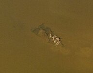
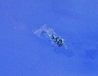
This vessel is laying on a downward slope with the aft end either broken off or buried in the mud. I have yet to dive on it but I have boated up to it. The only thing I could see at the surface was the small outcrops of vegetation growing on the bow area and my visibility was limited to just a few inches below the surface. If the scale on the map is to be believed, then this portion of the vessel is approximately 25' at its widest point and approximately 45' in length from the bow until the abrupt end to the outline.
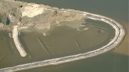
This location is on one of the old and unused passes of one of our area rivers that is a tributary to Pensacola Bay. It is certainly a wooden wreck but has mostly been covered in silt until the recent hurricanes. Older USGS photos of the same area actually show a tidal flat high and dry in the same location in 1999. During Hurricane Ivan in 2003, this immediate area sustained a 15-18 ft surge with 10-15 ft waves on top of that which obviously displaced quite a bit of sediment. The attached photo was dated from the fall of 2006 - 1 year ago but the site has not changed much since I last visited it in September of this year.


Your opinions of the nature of the vessel are appreciated. By the way, this is not the same river as the one that the HMS Mentor was taken in 1781 that my other post discussed.
Pcola

This vessel is laying on a downward slope with the aft end either broken off or buried in the mud. I have yet to dive on it but I have boated up to it. The only thing I could see at the surface was the small outcrops of vegetation growing on the bow area and my visibility was limited to just a few inches below the surface. If the scale on the map is to be believed, then this portion of the vessel is approximately 25' at its widest point and approximately 45' in length from the bow until the abrupt end to the outline.
This location is on one of the old and unused passes of one of our area rivers that is a tributary to Pensacola Bay. It is certainly a wooden wreck but has mostly been covered in silt until the recent hurricanes. Older USGS photos of the same area actually show a tidal flat high and dry in the same location in 1999. During Hurricane Ivan in 2003, this immediate area sustained a 15-18 ft surge with 10-15 ft waves on top of that which obviously displaced quite a bit of sediment. The attached photo was dated from the fall of 2006 - 1 year ago but the site has not changed much since I last visited it in September of this year.


Your opinions of the nature of the vessel are appreciated. By the way, this is not the same river as the one that the HMS Mentor was taken in 1781 that my other post discussed.
Pcola


 --- I think you know the one I'm talking about -----good luck ---Ivan


