"Deep Rock" Theory for Money Pit...

Zom

Jr. Member
Dec 8, 2019
81
42
USA
Detector(s) used
1975 White Discriminator. Sorry, my metal detector days are over.
Primary Interest:
Other
I did a forum search for the term "deep rock" and found nothing. I stumbled across this site https://www.oakislandcompendium.ca/...ical-discoveries-deep-in-the-money-pit-part-2 which had an interesting thought.


*The depth to bedrock in the general area of the Money Pit is between 145 and 160 feet, however, there is a cluster of holes where bedrock is not found until about 200 feet. We refer to this unusual feature as the Deep Rock area.
*Most of the Deep Rock holes had a thick layer of puddled clay just before the bottom of the hole.


Enough boreholes have been drilled in the general area of the Money Pit that we know the bedrock surface does not naturally vary by more than 10 or 15 feet in elevation except at the Deep Rock area. So either the Deep Rock area is a natural depression in the bedrock surface or it is a man-made feature.

But ....drilling records indicate that the sides of the Deep Rock area seem to be about vertical. Most natural bedrock depressions have sloping sides.

The thought is that if there's a 40' hole in the bedrock anomalous to surrounding bedrock... it's unlikely to be natural and might indicate human activity that punctured the bedrock which is why wood has been found BELOW bedrock. Here's their diagram https://www.oakislandcompendium.ca/uploads/6/9/1/8/69188499/figure-11-section-a-a.jpg?759
 

Last edited:
I did a forum search for the term "deep rock" and found nothing. I stumbled across this site https://www.oakislandcompendium.ca/...ical-discoveries-deep-in-the-money-pit-part-2 which had an interesting thought.


*The depth to bedrock in the general area of the Money Pit is between 145 and 160 feet, however, there is a cluster of holes where bedrock is not found until about 200 feet. We refer to this unusual feature as the Deep Rock area.
*Most of the Deep Rock holes had a thick layer of puddled clay just before the bottom of the hole.


Enough boreholes have been drilled in the general area of the Money Pit that we know the bedrock surface does not naturally vary by more than 10 or 15 feet in elevation except at the Deep Rock area. So either the Deep Rock area is a natural depression in the bedrock surface or it is a man-made feature.

But ....drilling records indicate that the sides of the Deep Rock area seem to be about vertical. Most natural bedrock depressions have sloping sides.

The thought is that if there's a hole in the bedrock anomalous to surrounding bedrock... it's unlikely to be natural and might indicate human activity that punctured the bedrock which is why wood has been found BELOW bedrock. Here's their diagram https://www.oakislandcompendium.ca/uploads/6/9/1/8/69188499/figure-11-section-a-a.jpg?759

Yea that's really interesting. I would say very high likelihood of being a man-made depression in the bedrock. They need to thoroughly explore the depression. Not just poke little holes in it and hope something interesting pops out. People tend to assume "Oh, for sure they didn't dig past the bedrock" and its like "Don't you think they knew you would think that?" Lol
 

Yea that's really interesting. I would say very high likelihood of being a man-made depression in the bedrock. They need to thoroughly explore the depression. Not just poke little holes in it and hope something interesting pops out. People tend to assume "Oh, for sure they didn't dig past the bedrock" and its like "Don't you think they knew you would think that?" Lol

Which raises the question if they just wanted to puncture and then hide something beneath the bedrock why start so high on the hill? I believe the east side of the island has been described as a drumlin... a pile of glacial till. The bedrock is easier to access on the west side... as we saw in the episode of the TV show where they investigate "the hatch". Of course the east side offered a bit more privacy. But if that was a concern... why not bury something on an island further out in the bay?
 

Which raises the question if they just wanted to puncture and then hide something beneath the bedrock why start so high on the hill? I believe the east side of the island has been described as a drumlin... a pile of glacial till. The bedrock is easier to access on the west side... as we saw in the episode of the TV show where they investigate "the hatch". Of course the east side offered a bit more privacy. But if that was a concern... why not bury something on an island further out in the bay?

Do you see the word that keeps repeating in your questioning? "Easy" ... I'm just saying, let's examine this for a minute. When you're hiding an enormous amount of wealth or other items of great importance and planning how to go about doing so in the most effective way, don't you think "easy" is the very last thing on your mind? It is safe to assume they had an army of slaves. So who cares about making it easy? These are lives that you have at your disposal. So you drive them to dig in the highest place, to the deepest most inaccessible depths possible. No matter how many collapse and die in the process. You just have to calculate things in a way to make sure you have enough lives at your disposal to accomplish your goal. These people would have been very effective at planning such things. The fact that its up on the hill just adds more validity to the theory, in my opinion.
 

Last edited:
Never Assume Anything...When Dealing With...The Freemasons!

Which raises the question if they just wanted to puncture and then hide something beneath the bedrock why start so high on the hill? I believe the east side of the island has been described as a drumlin... a pile of glacial till. The bedrock is easier to access on the west side... as we saw in the episode of the TV show where they investigate "the hatch". Of course the east side offered a bit more privacy. But if that was a concern... why not bury something on an island further out in the bay?

The Finger Drains in Smith's Cove are meant to be Drain Tunnels "Not" Flood Tunnels.

The Depositors needed the highest location on the Island to sink the Money Pit Shaft...thus...if anyone flooded the Shaft past the 90 foot level and blocked their West running Tunnel to the Treasure Vault...all they needed to do was open the Drain Tunnel to lower the water level within the Money Pit Shaft!

An old Jesuit...Trick!

Problem with this theory is the top of the Money Put is only about 30' above sea level... so 90' down would be 60' below sea level. You can check the topography yourself on Google Earth. Run the cursor over the money pit area and the elevation above mean sea level is shown below.
 

Last edited:
Do you see the word that keeps repeating in your questioning? "Easy" ... I'm just saying, let's examine this for a minute. When you're hiding an enormous amount of wealth or other items of great importance and planning how to go about doing so in the most effective way, don't you think "easy" is the very last thing on your mind?

No. It would be next in importance to "security," which would be my first concern. The two are closely related.

A big hole is a big job. Big jobs take time and labor. The more people that know about this, the less secure it is. If a random person actually sees me digging the hole, the game's up. If I ever want to recover that treasure later, I'm going to have to reverse the process - again, a big job, and I don't want anyone to see me doing it.

It is safe to assume they had an army of slaves.

Given that we don't know for sure that something is on Oak Island in the first place, let alone what it is and who put it there, I'd argue that it's not safe to assume anything at all - particularly the assets available to whoever might have done the burying.

From a security standpoint, would it make more sense to employ a gaggle of people to do a massive excavation, or might a more moderate effort - say, a couple of people, or maybe just me by myself - result in a treasure that's just as hidden, has left fewer traces behind, and has a far lower chance of someone spilling the beans after the fact?
 

Problem with this theory is the top of the Money Put is only about 30' above sea level... so 90' down would be 60' below sea level. You can check the topography yourself on Google Earth. Run the cursor over the money pit area and the elevation above mean sea level is shown below.

The top of of where the Money Pit is today...is not where it was 3 Centuries ago!
 

The top of of where the Money Pit is today...is not where it was 3 Centuries ago!

Even if it was the money pit area was even with the higher land around the pit, it doesn't get to more than 50' elevation. So you're still 40' below sea level at 90' deep in the pit.
 

Why are any of you assuming the entire area is 2-dimensional and can be understood by staring at a drawing on a flat piece of paper. If there was a crevice in the rock why could it not have vertical sides in 2 dimensions and look like a snaking feature in 3-dimensions? That sort of thing is absolutely natural. There's nothing to the suggestion of verticality that is forces us to deduce anything man made.

Going to the Oak Island compendium is diving into a lot of foolishness that is chronicled over there (good, bad and ugly). That site is maintained in order to keep the many suggestions about this never discovered treasure shaft alive and well. It's an attempt to have people pick and choose what they like most. If you do that Crowell and company have likely won you over.

No one has ever seen anything at that depth. They can't even see correctly when they lower hi-tech camera equipment to look immediately into the side of a bore hole without seeing embedded gold nuggets in the walls. It is all a great set of assumptions that is guided by what they can reason out with the mind of a treasure hunter. The mind of a treasure hunter will make one see things a certain way. He is no different than a man who has been hypnotized and thinks himself a chicken. You can never convince him of the opposite. Caveat Emptor.

Everything alleged to have been found as a hole feature has disappeared just as quickly as it has appeared. That is the great constant with the MP suggestion post-1848. The "mysterious energies"of Rick Lagina have moved things around to hide the conclusions that cannot be verified or confirmed even the next day. Everything has sunk into the abyss right as it was at hand. It wouldn't be so sad if it wasn't for the fact that the Enoch's vault myth instructs us that flooding and collapse are what ensue after one of three men is lowered into the proverbial inner ninth level by burton block. The OI stories stay faithfully true to the myths, and still no one blinks an eye in assuming we are given a literal account from day one.
 

And never trust the BS posted about Freemasons, by someone who is not a Freemason

No worries there. I don't trust any of the BS about Freemasons ancient rites or practices for the period prior to 1741 whether members or no. ;-)
 

Last edited:
No worries there. I don't trust any of the BS about Freemasons ancient rites or practices for the period prior to 1741 whether members or no. ;-)

You can't trust a literal interpretation of an allegory. That is all these people offer you. They have tons of very elaborate stories about all sorts of imaginary people, and some real. It all relates to one type of moral compass. There' s certainly no reason to be guided by it. We can interpret their shenanigans, though. You won't understand OI mythology without referring to ideas borrowed in Freemasonry. That doesn't mean you have to accept any of it. The OI grant planning and surveying was done by a NS Freemason. The same man is the same person who suggested that a "final solution" be put in place to "vacate" the French Catholics and "plant" New Englanders in those lands. That, unfortunately,came to be. William Morris eventually became a Superior Justice in NS. He's likely the inspiration behind Haliburton's "The Old Judge Character". You' re severely undercutting your ability to understand the earliest colonial History of OI if you won't consider the people who created a Lodge in Halifax in 1758.
 

Why are any of you assuming the entire area is 2-dimensional and can be understood by staring at a drawing on a flat piece of paper. If there was a crevice in the rock why could it not have vertical sides in 2 dimensions and look like a snaking feature in 3-dimensions? That sort of thing is absolutely natural. There's nothing to the suggestion of verticality that is forces us to deduce anything man made.

You're of course correct... that the info at that site is based on bore holes. But the seismic data the Laginas have should show how uneven the bedrock surface is over the money pit area and now much of the east side of the island. But all we ever see are two dimensional charts, nothing ever in 3D.
 

Just 40 feet Short...Of What?

Even if it was the money pit area was even with the higher land around the pit, it doesn't get to more than 50' elevation. So you're still 40' below sea level at 90' deep in the pit.

The Treasure Vault Tunnel did not necessarily have to be located at the 90 foot level...it could have been a hidden tunnel somewhere above it?

No one really knows how high the elevation was above the top of the depression stated to be the beginning of the Money Pit Shaft.

Sea Levels.jpg

Sea Levels have risen more than 30 inches since the construction of the Money Pit.

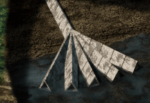
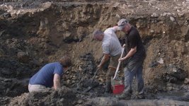
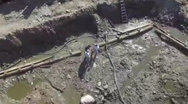
Pictures shows just how many feet below today's ground level these Drain Tunnels were and how much farther out on the shore, they may have gone.

Hidden Wharf 7.png

Oak Island - Smiths Cove Flood tunnels.jpg

Smiths Cove Drain Tunnel.jpg

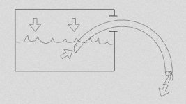
The Drain Tunnel would work as a Siphon capable of first siphoning the water above the 90 foot level then with suction, siphon the water to the 90 foot level... just like the principle of sucking gas out of a container!

Syphon Gas.jpg

We should find out the truth of whether they were Drain Tunnels or Flood Tunnels this season by...following them back to the Money Pit...if they stay at their present 50 foot level or go deeper as originally thought!


Freemason's Celestial Map March 2019.jpg
 

Last edited:
You can't siphon unless you are open to the atmosphere on both ends. Who's suggesting a siphon when there's an outlet under mud on one end.

The drain configuration in the cove is rather simple. You have a gravel packed trickle drain attached to a shallow vertical sump hole (what Restall termed the "vertical shaft"). That's where the drain feature originated inland. Restall confirmed it went nowhere beyond that with lots of trenching and intercept shafts. The Laginas won't even mention the existence of this shaft for fear of seriously undermining the old flood tunnel narrative they still exploit for content. Water was still observed draining out on the beach by Restall at low tide in his day. The sump hole just above the beach simply collected surface water to firm up the ground that had already been paved there with stones to keep it usable. These are very simple colonial works to try and reclaim firm ground above a well used beach.
 

Alan M & Robot
The bickering stops or you both will lose posting privileges. Act like adults and have a Happy New Year.
 

Happy New Year...To All...TreasurerNet!

Happy-New-Year-2020-Images-HD.png

May we come to understanding and peace in the New Year...2020
 

Alan M & Robot
The bickering stops or you both will lose posting privileges. Act like adults and have a Happy New Year.
Not to be contentious...I do not see were alan m posted on this Thread
 

Not to be contentious...I do not see were alan m posted on this Thread


Both your's and his posts were deleted. Please post by our rules, no insults, no attacks.
 

Last edited:

Top Member Reactions

Users who are viewing this thread

Back
Top