CAPT HOOKERS CACHE IN PARRISH,FLORIDA

ECS

Banned
Mar 26, 2012
11,638
17,695
Ocala,Florida
Primary Interest:
Other
CAPT HOOKER'S CACHE IN PARRISH,FLORIDA

Capt William B Hooker was an early settler in Manatee county,and owned 1000 acres around the Fort Hamer tract and the Manatee River,and was considered the "cattle king" of Florida in 1860.
On Jan 1,1861,Hooker sold his 10,000 head of cattle for $40,000,to James McKay who acted as agent for Jacob Summerlin.(McKay and Summerlin were involved with the CSA "cow calvary" out of Fort Meade,and has been detailed on many threads on TN).
When the Union began its occupation and raids on Florida's Gulf coast,Hooker buried part of his money(gold and silver specie) on his plantation,at "a boulder at the suns mid day shadow".
This was on his Fort Hamer tract,which he sold in 1867 to Charles A Turner for $1000,who named it Oak Hill,which became Parrish Florida.
Did Hooker recover his cache before the sale to Turner?
Then again,this is local lore and legend.
 

Interesting story, however I doubt he would have sold the land without recovering the money first...

sent from a potato...
 

Capt William B Hooker was an early settler in Manatee county,and owned 1000 acres around the Fort Hamer tract and the Manatee River,and was considered the "cattle king" of Florida in 1860.
On Jan 1,1861,Hooker sold his 10,000 head of cattle for $40,000,to James McKay who acted as agent for Jacob Summerlin.(McKay and Summerlin were involved with the CSA "cow calvary" out of Fort Meade,and has been detailed on many threads on TN).
When the Union began its occupation and raids on Florida's Gulf coast,Hooker buried part of his money(gold and silver specie) on his plantation,at "a boulder at the suns mid day shadow".
This was on his Fort Hamer tract,which he sold in 1867 to Charles A Turner for $1000,who named it Oak Hill,which became Parrish Florida.
Did Hooker recover his cache before the sale to Turner?
Then again,this is local lore and legend.

I moved to Parrish in 1982. I know a lot of the history. It was a big time cattle industry town. My younger brother lives in Parrish and has a herd of cattle. He lives near Ft Hamer Road. A lot of people do not know where the site of the old fort was. It was actually on the south side of the river and Ft Hamer road is on the north side. I used to barefoot ski up and down the river and there is a wide spot where the boat would turn around. It would whip me around and I would be going about 75 miles an hour. I had my worst crashes at this spot on the river. This is right where Fort Hamer stood.


Image17.jpgThis photo is right near the old fort site. I have two locations that I want to detect and possibly dig. They are on two different properties. I have talked to both owners. We have mutual acquaintances and I think I will have no problem getting a written contract. I talked to Kellyco today about the repair on the Nokta Golden King. They are hoping to have it ready for me very soon. I have a lot of places to take it. One of the spots at the fort site is a high point on the bank and I have a very good feeling about it.
 

Last edited:
Sounds like a good guess. The forts were usually on the higher ground. I am lining up a 1600 fort site on an island. I did a topo check and there is only one good spot on the island, a high spot neat the waters edge.
Good luck on your search, Frank...111-1 profile.jpg
 

Great story. I drive through Parrish on a regular basis so will follow this thread just out of interest. Hoping for a great tale!!!
 

ECS-Do you know where the Turner property was? My younger brother's ranch is part of the old Cary Cattle Company property. I think they were mainly in Brandon but they had property all over the area. There are some interesting sites on my brothers property. Huge oaks, creek, and there were some very old fences. The Ft Hamer fort site is just south of the curve in the Upper Manatee River road area. The old guy that lives in a big fancy house where the fort was did not even seem to know about a fort having been there. Research at the historical society has confirmed where the exact spot was. I have a number of reasons to believe there may be a big cache buried on the high bank of the river. One of the guys on my team used to be the president of the historical society. Research, research, and research some more, that is the key.
 

Nokta Detectors claims to go much deeper than similar priced units. They are secretive about how this
claim is achieved. You might ask Blake for proof in the form of deep targets found exclusively with the
Noktas. Detector manufactures have been making these claims since the '70s and some of them proved
inconsistent with reality. You can test them out with a simple bench test. Put it on a flat table in the
showroom with the coil pointed straight up. Have the salesman turn it on and adjust it for all-metal
detection. Begin waving your pocket change horozontaly with the coil. Keep backing up until no signal
is heard. Measure the distance and you will have a good idea of how deep it will go. Florida's soil has
no inherent mineralization to affect depth. This test will only take a few minutes and will confirm or
deny the claims Nokta makes. You could take an iron kettle to see how deep a cache could be
detected. The sounds thereof would be like you encounter in the field. Good luck and all the best.

I am not ready to accept any claims at face value. Whether it be how deep a detector detects, how deep a backhoe will actually dig, whether an LRL actually works or whether a dowser can find anything. The Nokta is way more complicated than just making sounds. It has 4 individual displays on the separate computer screen. It will show you depth, what it thinks is buried (gold/silver, etc) the shape, and more. I also don't believe in air-testing a detector. We buried lead in the ground and measured exactly how deep we put it. We tested all our detectors that we had with us. I will be hand burying objects at Kellyco to see for myself how well a detector works. We will be getting more instruction from Blake at Kellyco when we pick up the detector.
 

Last edited:
Why are you hung up on backhoes and bulldozers? Don't you realize most caches are at the most
3-4 feet deep? What landowner is going to let you trash their property with a bulldozer? If you did
bulldoze a cache you would likely destroy the contents. In fifty years of treasure hunting I have not
heard of ONE cache hunter using a bulldozer as their primary cache finder until you started posting.
 

Lastleg you obviously have not heard of the "cave with the iron door." One of the most famous treasure stories. The searchers used a Caterpillar D-8 bulldozer to search for the cave entrance.

You said most caches are found 3-4 feet deep. How many are found 3-4 feet deep compared to 10-20 feet deep? Do you have any statistics to back up your statement?

So far every landowner BDD has contacted has given him permission to trash their property with a backhoe. Haven't you seen the pictures he posted? In my 30 years of treasure hunting I have found that only the serious thunters use a backhoe.
 

Last edited:
Why are you hung up on backhoes and bulldozers? Don't you realize most caches are at the most
3-4 feet deep? What landowner is going to let you trash their property with a bulldozer? If you did
bulldoze a cache you would likely destroy the contents. In fifty years of treasure hunting I have not
heard of ONE cache hunter using a bulldozer as their primary cache finder until you started posting.

Please give me the thread and post number of where I have ever mentioned using a bulldozer. I have 1255 posts. Get ECS to help you. I have never used a bulldozer and have no intention of it. I am gearing up for the big one and I plan on digging it all by myself using a hand shovel. A small hand shovel at that.
 

Lastleg you obviously have not heard of the "cave with the iron door." One of the most famous treasure stories. The searchers used a Caterpillar D-8 bulldozer to search for the cave entrance.

You said most caches are found 3-4 feet deep. How many are found 3-4 feet deep compared to 10-20 feet deep? Do you have any statistics to back up your statement?

So far every landowner BDD has contacted has given him permission to trash their property with a backhoe. Haven't you seen the pictures he posted? In my 30 years of treasure hunting I have found that only the serious thunters use a backhoe.

Actually no one wants me to trash their property. As a matter of fact we remove all trash found while excavating and usually leave the property in better shape than when we started. They have all given me permission to use whatever equipment I feel I need and if that means using a track hoe, well, we CAN DIG IT!
 

Salvor 6: I've heard just about all the supposed treasure yarns, the iron doors, wooden doors, you
name it. What I haven't seen is someone hauling a backhoe into the mountains to trash the environment.
But if that's your thing I hope you can afford the fines. Best of luck.
 

Salvor 6: I've heard just about all the supposed treasure yarns, the iron doors, wooden doors, you
name it. What I haven't seen is someone hauling a backhoe into the mountains to trash the environment.
But if that's your thing I hope you can afford the fines. Best of luck.

I suggest you watch "Gold Rush" on TV. They haul backhoes into the mountains and jungles. Trashing the environment is their thing. Watch "Bering Sea Gold". They dig the ocean floor up with a big backhoe. We dig very small holes very carefully looking for caches that were buried in the past. Put a "thumb" on the backhoe scoop and my guy Dan could pick the dingle berries off your backside without causing any damage to your hemorrhoids. Down here in Florida we are playing in the sand and don't do a fraction of the damage that I see on a daily basis due to new construction. lastleg-You are barking up the wrong tree. Fines? For what?
 

Getting back to Capt Hooker's cache-What is the meaning of "a boulder at the suns mid day shadow"? Florida is not known for its boulders unless it is a reference to a limestone cap stone.
Seen any boulders in your neighborhood,BDD?
 

I assume Alaska/Canada makes miners restore the damage they make. Of course Discovery doesn't show
this happening - too boring. And Discovery is financing them all the way. Bering Sea Gold creates no
environmental damage, like how could you reclaim the ocean? Did you notice the filling in of the glory hole?
Now why did they do that? Because the state required it.
 

Getting back to Capt Hooker's cache-What is the meaning of "a boulder at the suns mid day shadow"? Florida is not known for its boulders unless it is a reference to a limestone cap stone.
Seen any boulders in your neighborhood,BDD?

I know where a house is with a boulder in the front yard. There is a really big reclanata palm tree nearby. If I remember correctly this boulder has a big hole going all the way thru in the middle of it. It is made of limestone or maybe even coral.

This property backs up to the large piece of property that was a part of a big cattle ranch. It was owned by the Cary Cattle Company. I think that is how it was spelled. Years ago some guys came to my friends house and claimed there was treasure buried by the pond in the back yard. They dug around but could not find anything. Later on my friends grandfather found some old coins in the water near the edge of the pond. I think they may have been gold. There is a lot more to this story.

I also have a boulder in my yard. It is man made out of tabby concrete. At least that is what I think it was. The street near my house was part of the original Tamiami trail. Not far from my house is a creek and there used to be an old building there. My neighbor said it was the old post office and stage coach stop going back to Civil War days. My house sits on an old farm. When I was digging a small fish pond right behind my house I joked to my wife that it would be funny if I found some treasure. The next morning I was shaping the sides of the pond and found an old piece of metal that looks like it came from a ship. I will take a picture of it and post it on here soon.

I have a huge 500+ year old oak tree next to my garage. There are four big oak trees that are in an exact line. I have had a half a dozen people tell me there is treasure buried on my property. Who knows?
 

Last edited:
I assume Alaska/Canada makes miners restore the damage they make. Of course Discovery doesn't show
this happening - too boring. And Discovery is financing them all the way. Bering Sea Gold creates no
environmental damage, like how could you reclaim the ocean? Did you notice the filling in of the glory hole?
Now why did they do that? Because the state required it.

So you think it is okay for them to use backhoes, but not me? Like I said, I do no damage and fill it all back in. We rake it smooth and it does not take long for the grass to grow back. No harm done.
 

I think you should instruct the camera crew to show you restoring the mess you made for the sake of
our hobby.
 

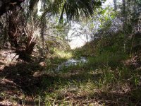
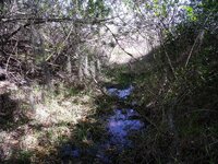
What's left of the original Fort Hamer road...


DSCF1229.jpg


DSCF1231.jpg


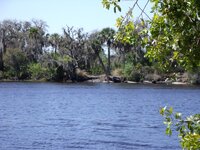
Looking across the river to the landing of the ferry at the fort site....


DSCF1233.jpg


BDD is right, the fort was on the south side of the river at a southern turn, on what is nearly an island. There is a lot of low land there, and it is hard to imagine that it was suggested that headquarters at Tampa's Fort Brooke should be transferred to Fort Hamer.....But it was the head of steamboat navigation of the river, and might have already had piers, and docks, and the military was big on water navigation during the Third Seminole War, and many forts were built on the rivers of the area.

Fort Hamer was a military preserve, and not subject to sale, at the time, so "the Fort Hamer tract" was probably from the ferry crossing on the north bank of the river north to whatever was the northern boundry of his land...(maybe the Little Manatee River).

An 1857 map by F.M. Follet shows Hooker's homestead in about the middle of what is now Parrish, in the vicinity of hwy. 62, east of U.S. 301, probably along Gamble creek.
 

Last edited:

Top Member Reactions

Users who are viewing this thread

Back
Top