R
R.Whit
Guest
Hello, Can some of you tell me if there was a skirmish, battle or campsite in this area? I know it is close to Ft. Smith Arkansas but could use some expert advice if anything happened here.
I was going to post a map but was afraid I'd screw something up so I'll try and describe the area to you.
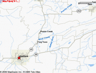
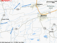
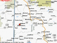
Location: Sebastion County, Arkansas. If you look at a map the place is in an area encircled and surrounded by four towns. They are Hartford, Midland, Huntington, and Mansfield. The Highway's that are near the towns are 96, 252, and 378. The closest intersection to the property is Frazier Road and James Fork Road.
I know a map would have made things much easier and I apologize. I would greatly appreciate any thoughts, opinion or knowledge if you know of anything happening here or if you suspect it may or may not be a good site for CW relics.
Thank you very much for your time and thoughts!
Upvote
0


