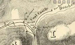
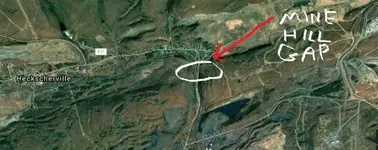
[h=1]Topographical map of the Mine Hill and Schuylkill-Haven Rail Road with its branches and extension to Ashland; surveyed and drawn by Henry W. Poole, Civl. Topl. Ming. Engr. Pottsville, Pa. Dec. 1854, to accompany the Report to the stockholders.[/h]
Click Here for Entire Map:
https://www.loc.gov/resource/g3823s.rr004670/?r=0.645,0.341,0.142,0.074,0


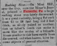
Cherokee phoenix, and Indians' advocate. [volume] (New Echota [Ga.]), 08 May 1830.

https://chroniclingamerica.loc.gov/...ext=&andtext=&dateFilterType=yearRange&page=1
Click Here for Entire Map:
https://www.loc.gov/resource/g3823s.rr004670/?r=0.645,0.341,0.142,0.074,0


Cherokee phoenix, and Indians' advocate. [volume] (New Echota [Ga.]), 08 May 1830.

https://chroniclingamerica.loc.gov/...ext=&andtext=&dateFilterType=yearRange&page=1


