lost padres mine?

The latest info I found about The lost Pdre La Rue is that it was located on white sands missile complex and used as a observation post. Some believe it is the one of the first hills you past after going over the San Augustine pass. You can see digging from the highway along route70 but you cant go look. Besides very modern monitoring devices there is a armed response to any trespassers. From what I have been told, the area was used for more than nuclear test and very dangerous without proper equipment. I do know most of the heavy minerals are on the east side of the Organ mountains as confirmed by a geologist who did a study. I have found very little gold, but have found some silver ore that had trace amounts of gold or copper in the surrounding ranges. Most of the area is now protected as a National Park. You can look, but not touch so to speak.
 

I am filming a documentary on The Lost Padre Mine

I see most of these posts are years old. However, I am only now seeing them for the first time.Therefore I am replying now for anyone interested. Yes it is in the Franklin Mountains on the East side. Only parts of the legend directions are true. That's why using the legends directions from the Church in downtown yield no useful information. Yes it is a certain time of year. yes it is a certain time of day. But the starting point is not the church. I know the day- time of year direction to look and time of day. I have been to the remnants of the mine and the angles of the mine are exactly that of an old Spanish mine in depth angle and a 90 degree turn as prescribed in Spanish mines. It is simply too deep, 180 feet + to recover and on privately owned land by a local family trust on the mountainside. I have the original manuscript directions and have all of the information anyone needs if interested.

I am very interested in seeing these directions and this manuscript, as it will help greatly in filming this documentary. For more details about who we are, you can find us on YouTube as "American Decay"
 

As for the lost padre of Arizona. not New Mexico, Texas or any of the others. here is the translation from Cpt. Farfan's find.

Next
morning they set out from this place in the same direction,
and having travelled about three leagues they found a river which flowed towards the north, of moderate width and carrying considerable water, with many cottonwoods, level banks,
and little pasture.
And travelling on in the same direction they reached the
slope of a mountain range in time to camp for the night,
having gone about another [three] leagues. They camped
without water, and the next morning they set out from this
place ; and after going two leagues they arrived at a grove of
small pines, and at a very deep pool, which was ample to
water all the horses and more if there had been more. Travelling on for two leagues along the mountain range, which was covered with snow, they camped for the night on a slope
where was found a small amount of grass for the horses.

if any are interested I will add more of the report but in a final not the mines are not far from here.
 

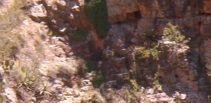
Sea turtle in middle of pic.
 

Attachments

  • sea turtle.jpg
    sea turtle.jpg
    120.8 KB · Views: 36
Sea turtle in middle of pic.
The picture does not say much without some context. What is around it, what is the history. Also mating turtles are more telling at certain mines. To some it would be hard to understand what your saying here. The mine is most likely not lost and in a place it cant be explored anymore.
 

Top Member Reactions

Users who are viewing this thread

Back
Top